Click to enlarge the image
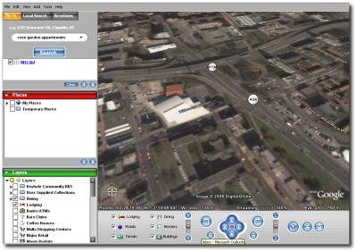
 oogle Earth is a project which strongly impresses me. I got hold of a Windows machine where Google Earth had been installed and grabbed a few screenshots of streets around Manchester, UK.
Given the satellite data, this technology is not overly innovative. All that is required are mappings of existing satellite images onto a sphere, then relying on OpenGL acceleration. The real issues to be faced are bandwidth and Google’s progress on 3-D geographical data acquisition.
What screenshots cannot show is the excellent real-time interaction with the scene. Roads, street names and other details can be toggled on/off. There is also some highly continuous motion when hovering from one place to another. To get a better impression, you may wish to view this gallery with more sample images.


 Filed under:
 HE devastating effects of Hurricane Katrina have been caught by Google Earth’s eye. Constant footage of the ground is made possible owing to many recently-acquired overlays. The devastation is very clear as reflected by before/after snapshots, which can be viewed interactively in Google Earth.


 Would you believe that a base unit with a monitor can be sold for as little as $225? Although there is no mentioning of the O/S and software that is included, buyers can get it all for a mere pittance in India. There are some amazing offers in westernised countries as well. In the UK, for example, a Linux box can be as cheap as
 Google have introduced yet another ‘toy’ which re-uses the software from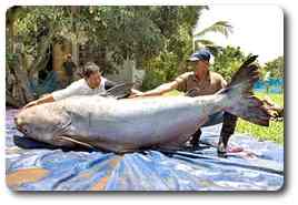
 hown above is an enormous catfish. Even my Thai colleague was flabbergasted by the image on my monitor. My strict diet relies on fish so I could not resist posting this picture which demonstrated the size of the very unusual ocean salvage. Unfortunately, it will end up on somebody’s table.
 OV-Ray, an Open Source 3-D rendering package that could compete with the commercial Maya,